**** Info via Environmental Canada
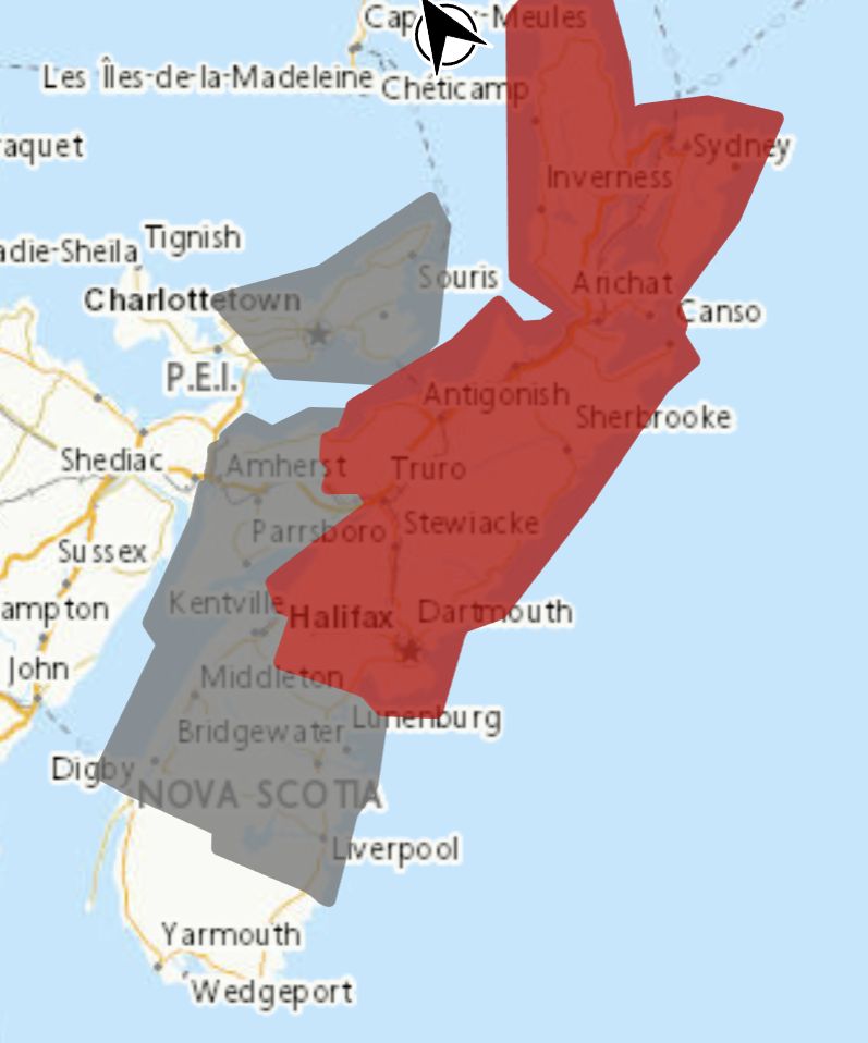
Blowing snow statement in effect, snowfall warning continues

Poor visibility in snow and blowing snow is expected or occurring in some locations.
Maximum wind gusts: 70 to 80 km/h.
Locations: most of central and northern Nova Scotia.
Time span: Sunday morning until Monday morning.
Remarks: Conditions will deteriorate Sunday as strengthening winds combine with fresh snowfall to cause widespread blowing snow.
Visibility may be significantly and suddenly reduced to near zero.
Blowing snow advisories are issued when winds are expected to create blowing snow giving poor visibility to 800 metres or less for at least 3 hours.
Snowfall warnings are issued when significant snowfall is expected.
Snowfall warning update
A prolonged period of snowfall is expected.
Locations: Central Nova Scotia.
Additional snowfall: 15 to 25 cm.
Time span: continuing until Monday.
Remarks: A low pressure system has stalled south of Nova Scotia resulting in a prolonged period of snow. There will be a brief break in heavy snow overnight tonight, before intensifying again on Sunday afternoon. The highest accumulations are expected during the day today. Snow will be wet and heavy, which could cause strain on utility lines.
Additionally, increasing northeasterly winds could result in reduced visibilities in blowing snow this weekend.
Snow will taper to flurries on Monday.
Visibility may be suddenly reduced at times in heavy snow. Surfaces such as highways, roads, walkways and parking lots may become difficult to navigate due to accumulating snow. Heavy snowfall accumulation may cause tree branches to break.
Snowfall warnings are issued when significant snowfall is expected.
Please continue to monitor alerts and forecasts issued by Environment Canada. To report severe weather, send an email to [email protected] or tweet reports using #NSStorm.
Source
https://weather.gc.ca/?province=ns&zoom=6¢er=45.19824332,-62.94777135


