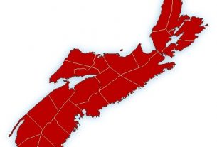
**** Info via Environment Canada
Additional advisory
Rainfall warning in effect

Heavy rain is expected.
Total rainfall: 50 to 100 mm, local amounts possible reaching 150 mm.
Locations: central and northern Nova Scotia, and northern and eastern Cape Breton Island.
Time span: Friday through Saturday afternoon.
Remarks: A trough of low pressure will bring rain to the region on Friday. This trough will then merge with approaching Hurricane Fiona on Saturday and will bring intense and torrential rainfall to the region. Rainfall rates in excess of 25 mm per hour are possible beginning later Friday night and will continue into Saturday. Rain will finally ease off then end during the day Saturday.
Past storms with these rainfall rates and total accumulations have caused hazardous driving conditions, elevated river levels, road closures, and localized flooding, especially in poor drainage areas.
Heavy downpours can cause flash floods and water pooling on roads. Localized flooding in low-lying areas is possible.
Please continue to monitor alerts and forecasts issued by Environment Canada. To report severe weather, send an email to [email protected] or tweet reports using #NSStorm
Source
https://weather.gc.ca/warnings/index_e.html?prov=ns
Hurricane watch in effect
There is a possibility that Hurricane Fiona could bring near-hurricane conditions.
This watch is in effect for Saturday. Some areas under this watch may be upgraded to a hurricane warning tonight at which point we will begin to forecast specific wind speeds.
For the Halifax area in particular, hurricane conditions (inland gusts to 120 km/h) may not occur but we will have a better idea tonight.
A hurricane watch means that hurricane conditions are possible over parts of the region within 36 hours. Hurricane conditions include (A) sustained winds near 120 km/h or more, and/or (B) significantly elevated water levels and dangerous surf along the coast.
By nature, a hurricane also implies the threat of local flooding from heavy rainfall – consult your local area forecast for possible rainfall warnings.
Please continue to monitor alerts issued by the Canadian Hurricane Centre and forecasts issued by Environment Canada. Reports of storm conditions and impacts can be emailed directly to [email protected] or by tweeting reports by province using #NSStorm, #NBStorm, #PEStorm, #NLwx, #QCStorm or #ONStorm.


