**** Info via Environment Canada
La Niña might persist until 2023
According to the World Meteorological Organization (WMO), there is a high probability that the ongoing La Niña event, which has intensified drought and flooding in different parts of the world, will continue until fall and the start of winter in the northern hemisphere.
The current La Niña event started in September 2020. If it persists into 2023, it would be known as a “triple dip” La Niña since it would be occurring for a third consecutive year. This would only be the third time this happened since 1950.
What is La Niña?
La Niña refers to the large-scale cooling of the ocean surface temperatures in the central and eastern equatorial Pacific Ocean, combined with changes in the tropical atmospheric circulation, namely winds, pressure and rainfall. It usually has the opposite impacts on weather and climate as El Niño, which is the warm phase of the El Niño Southern Oscillation (ENSO).
What influence does La Niña have on Canada?
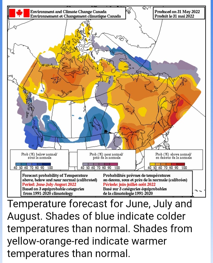
This summer, La Niña is combined with a negative Pacific Decadal Oscillation (PDO), which is also a variation of the sea surface temperature in the Pacific Ocean. This can mean more rain and perhaps less wildfire in parts of Western Canada. In comparison, Eastern Canada is only partly influenced by La Niña, but it does explain why we can expect warmer temperatures than average this summer, with Ontario and Quebec seeing more storms and the Atlantic Provinces bracing for an above average hurricane season.
To explore further, look at our seasonal forecasts.