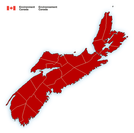
**** Info via Environment Canada

—- ALL ENDED
Update – Rainfall warning in effect
Rainfall, combined with melting snow, is expected. The frozen ground has a reduced ability to absorb this rainfall.
Significant rainfall expected for southwestern Nova Scotia.
Total rainfall: 30 to 60 mm.
Locations: Halifax area through to southwestern Nova Scotia.
Time Span: tonight through Saturday.
Remarks: Periods of rain today will intensify tonight and continue through Friday and Friday night. Inland areas will see significant freezing rain and freezing rainfall warnings are in effect for some counties. Precipitation will change to snow Saturday morning then taper off to scattered flurries Saturday afternoon.
Localized flooding in low-lying areas is possible. Watch for possible washouts near rivers, creeks and culverts.
Freezing rain warning in effect
A winter storm will bring an extended period of potentially severe freezing rain.
Locations: most of Nova Scotia.
Time Span: tonight through Saturday.
Remarks: Periods of rain will transition to freezing rain and ice pellets later tonight or Friday morning. Freezing rain will become heavy at times and continue through Friday evening into Saturday morning. Current guidance indicates a risk of significant ice accretion on surfaces by Saturday morning.
Surfaces such as highways, roads, walkways and parking lots will become icy, slippery and extremely hazardous. Beware of branches or electrical wires that could break under the weight of ice. Extended and widespread utility outages are possible.
Please continue to monitor alerts and forecasts issued by Environment Canada. To report severe weather, send an email to [email protected] or tweet reports using #NSStorm.
Source


