**** Info via Environment Canada
La Niña is back
After observing La Niña conditions emerging in the tropical Pacific Ocean over the late summer and early fall, we can say that La Niña is officially back for a second year in a row. It should reach its peak towards the end of 2021, and then ease off in spring 2022.

What is La Niña?
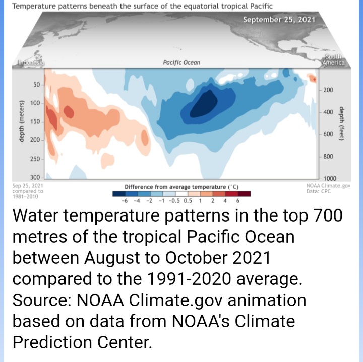
La Niña is a natural recurring ocean-atmospheric phenomenon that manifests itself by cooler-than-average sea temperatures across the central and eastern Pacific Ocean near the equator. It is the cold phase of the El Niño Southern Oscillation (ENSO), and usually has the opposite impacts on our weather as El Niño, which is the warm phase of the ENSO. El Niño is translated as “Little Boy” in Spanish, and thus the opposite effect has been coined as La Niña – which translates to “Little Girl” .
La Niña occurs when trade winds increase in strength, pushing warm water towards Asia. As the wind-driven tongue of warm water extends west, cold water from the deep rises to the surface off the west coast of South America. This growing tongue of cold-water in the Pacific helps to redirect the jet stream northwards, which in turn then affects the location and strength of storm paths.
Impacts on Canada’s winter
In Canada, we can expect above average precipitation in British Columbia. Colder-than-normal temperatures can be expected in the Prairies, with some blasts of bitterly cold air in southern Prairies. We can expect above average precipitation in Ontario and Quebec. La Niña usually does not have any impacts on Eastern Canada.


