**** Info via Environment Canada
Who are the hurricane hunters?
When it comes to the most intense storms on Earth, most aircraft generally avoid flying anywhere near them for the safety and comfort of the passengers and crew. But a small group of aviators, scientists, and engineers fly science and research missions directly into the heart of tropical cyclones as part of their jobs, and yes, it can get bumpy!
These are the Hurricane Hunters.

Adding value to hurricane forecasts
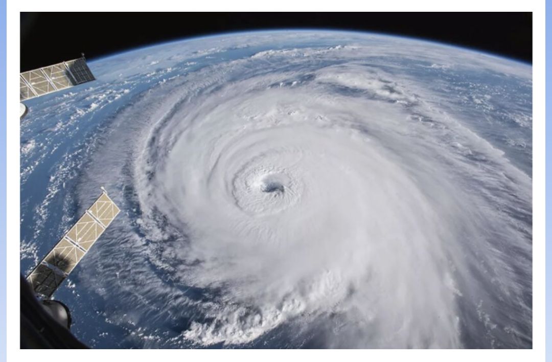
The accuracy of weather models’ output that we use to make forecasts depends heavily on the quality and amount of weather observations collected on and above the Earth’s surface. In hurricane country, these observations come from weather stations on land, moored buoys, drilling platforms, and even ships and aircraft. Weather balloons, satellites, and land-based radar also play a critical role in observing the weather throughout the atmosphere.
However, large areas of the tropics are not adequately covered by weather instruments. That’s when hurricane hunters step in.

National Oceanic and Atmospheric Administration (NOAA) hurricane hunters’ planes in Lakeland, Florida. These planes are equipped with weather instruments that provide essential data for forecasting hurricanes. Credit: NOAA.
Hurricane hunters’ planes are heavily equipped with sensors that measure temperature, humidity, pressure, and wind. Some are equipped with other instruments, such as weather radars, allowing them to capture high-quality scans of the storms in areas far from land-based radars. Moreover, the aircraft often deploy special instruments called “dropsondes.” These work like the ones used with weather balloons and provide highly precise data on surface winds under a hurricane’s eyewall, along with other important observations.

The spectacular “stadium effect” that can be seen when penetrating the eye of a hurricane. Air is notably smoother here than in the ring of towering thunderstorms that comprise the eyewall. Credit: NOAA.
Typically, missions last around eight hours, and planes fly about three kilometres above the Earth through the storm. The aircraft usually passes through the eye of the storm at least twice, making a series of left-hand turns in an alpha pattern. This helps them collect data from all parts of the storm while avoiding the strongest headwinds. If a severe tropical cyclone requires constant monitoring, crews conduct missions every six hours.

Hurricane Hunters fly missions in both the eastern and central Pacific for tropical cyclones that could threaten Hawaii and the west coast of North America, as well as in the Gulf of Mexico, Caribbean Sea, and western North Atlantic for storms threatening the Gulf and east coasts. Credit: NOAA.
This critical, real-time data is transmitted back regularly to the National Hurricane Center in the United States. It is then added to weather models to assist meteorologists in creating more accurate forecasts for the storm’s path, its intensity, and potential impacts on land. This kind of data gathering wouldn’t be possible via more conventional methods.
The Canadian Hurricane Centre and the US National Hurricane Center collaborate closely to monitor and predict tropical storms and hurricanes affecting North America. They exchange vital meteorological data, conduct joint research, and share expertise in forecasting and emergency response. Both organizations also engage in public awareness campaigns and international cooperation to enhance hurricane preparedness and response globally.
For more: Hurricane forecasts and facts.