
**** Info via Environment Canada
Deep freeze paralyzes large parts of Canada
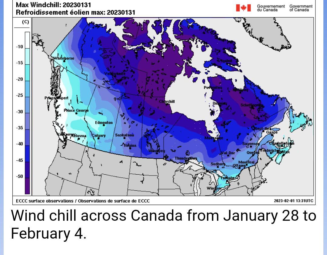
The majority of the country is now out of a cold snap that lasted from January 28 to February 4. You were right if you thought that the frigid cold was a little colder than we usually expect at this time of the year. Temperatures were 10 to 15 degrees below normal.
On February 3 and 4, the weather was particularly cold in eastern Ontario, Quebec and the Maritimes, with temperatures ranging in the 2% coldest ever recorded and with many setting new cold records.
The effect of the cold in the east was amplified by sustained winds that created a wind chill between -40 and -50 for more than 24 consecutive hours. The wind chill even reached -59 in Tasiujaq in northern Quebec!
The fact that a four-week-long warm spell lingered in the West from December 23 to January 27 and an even longer one lingered in the east from the end of November to the end of January probably increased the perception that the cold was even more extreme.
Interestingly, on February 2, 3 and 4, a rise in temperatures on the West Coast created a 50-degree contrast with the east! Temperatures were around +5 °C in coastal British Columbia and around -45 °C in northern Quebec.


