**** Info via Environment Canada
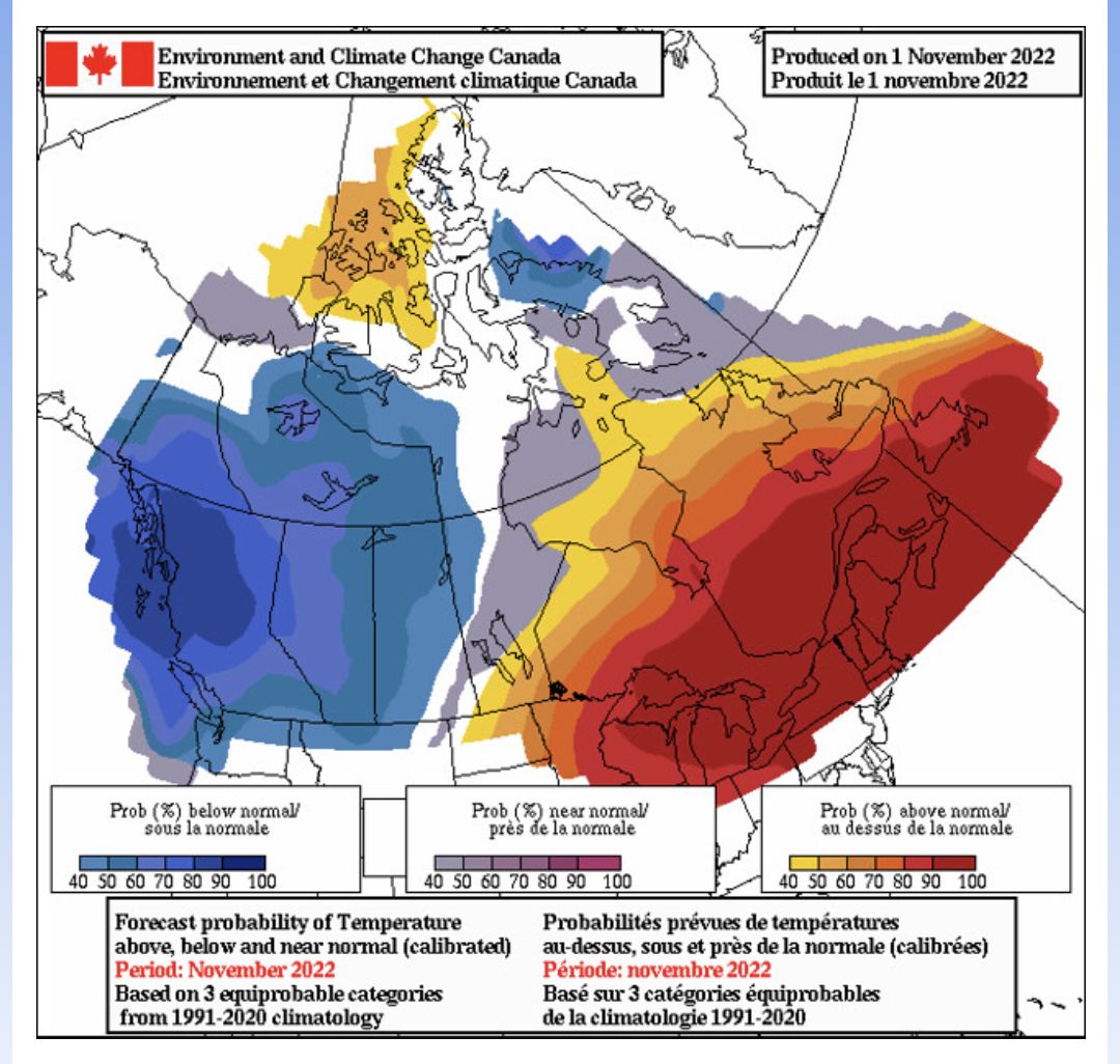
November temperature outlook
October was another warm month across most of Canada except southern Ontario and southern Manitoba, where temperatures were closer to average overall. The 25 and 26 were particularly warm through Quebec and the Maritimes, with many temperature records broken and Montreal’s latest occurrence of a 30 humidex.
Precipitation varied across the country, with some areas seeing a wetter than the average month and others seeing dryer-than-average conditions. Along the coast of British Columbia and over Vancouver Island, October was very dry until the end of the month when heavy rainfall developed.
Despite the generally warmer-than-average temperatures across the country, October brought the first taste of winter in many areas. Northern Quebec and Labrador saw their first heavy snowfall on October 7 and 8. From October 10 to 11, the Northwest Territories were hit with heavy snow. From October 17 to 20, northern and central Ontario saw heavy snowfall and freezing conditions that led to road closures, multiple traffic accidents and power outages. From October 21 to 24, the Prairies experienced their first heavy snowfall of the year, with heavy wet snow mixed at times with freezing rain causing road closures and power outages. From October 27 to the end of the month, blizzard conditions developed in and around Iqaluit.
Here is the forecast for the “temperature anomaly” for the month of November. The temperature anomaly is the “difference from normal temperatures” for the entire month.
The forecasts are categorized as follows:
- blue indicates the probability that temperatures will be below normal;
- grey to purple indicates the probability that temperatures will be near normal; and
- yellow to red indicates the probability that temperatures will be above normal.
*All categories are compared to the 30 seasons of the 1991-2020 period.
Long range forecast user guide.


