**** Info via Environment Canada
March Temperature Outlook
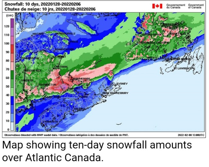
February in review: An elongated frontal boundary, which stretched from Atlantic Canada to the southern US, produced various types of precipitation with significant impacts from February 3rd to 6th. A large portion of Nova Scotia received significant amounts of freezing rain, while St John’s, NL reported it falling for 18 straight hours. Heavy snow was reported in southern New Brunswick as well as in Prince Edward Island, while a whopping 179.8 mm of rain fell in Mount Carmel, NL.
Extremely cold conditions returned to the Prairies on February 22 and 23. Nordegg, Alberta broke a record cold low on the morning of the 23rd at -36.3 °C, beating the old record of -33.3 °C set in 1917.
March is starting off colder than normal in all regions except for southern British Columbia and Alberta.
Here is the forecast for the “temperature anomaly” for the entire month of March. The temperature anomaly is the “difference from normal temperatures” for the entire month.
The forecasts are categorized as:
- blue indicates below normal temperatures;
- white (no colour) indicates near normal temperatures; and
- red indicates above normal temperatures – all categories are compared to the 30 seasons of the 1991-2020 period.

This is a prediction of the anomaly of the mean daily temperature at 2 metres (i.e. at standard temperature observation height). It is not a forecast of the maximum nor of the minimum daily temperature.
Long range forecast user guide.