**** Info via Environment Canada
—- ENDED
Special weather statement in effect
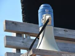
Significant Winter storm giving snow, rain, strong winds and storm surge.
Time Span: Friday night and Saturday.
Locations: Mainland Nova Scotia and Cape Breton
Snowfall: Highest snowfall amounts ranging from 20 to 40 cm are expected over western and northern parts of the province.
Rainfall: Highest rainfall amounts ranging from 30 to 50 mm are expected over
eastern Nova Scotia from Halifax to Cape Breton.
Wind: Gusts near 100 km/h are expected over a majority of Nova Scotia and Cape Breton starting Friday night.
Storm Surge and Waves: Higher than normal water levels combined with
significant waves may result in flooding near high tide, especially for
the Atlantic coast, Cape Breton Island, and Pictou and Antigonish Counties.
High tide will occur between 6:00 to 7:00 pm Friday evening and 6:00 to 7:00 am Saturday morning.
Please continue to monitor alerts and forecasts issued by Environment Canada. To report severe weather, send an email to [email protected] or tweet reports using #NSStorm.
Source