**** Info via Environment Canada
ENDED

Snowfall with total amounts of 20 to 30 cm is expected.
Snowfall warning in effect

Time span: This morning until overnight tonight.
Remarks: Snow will develop this morning in the west and spread to the rest of the province by this afternoon. Generally 15 to 25 cm of snow is expected however 30 cm or more is possible over northern and eastern areas of the province. Furthermore, strong east to northeast winds gusting to 60 to 80 km/h may significantly reduce visibility in blowing snow.
Rapidly accumulating snow will make travel difficult. Surfaces such as highways, roads, walkways and parking lots may become difficult to navigate due to accumulating snow. Heavy snowfall accumulation may cause tree branches to break.
Snowfall warnings are issued when significant snowfall is expected.
Please continue to monitor alerts and forecasts issued by Environment Canada. To report severe weather, send an email to [email protected] or tweet reports using #NSStorm.
Special weather statement in effect via Environment Canada

Significant snowfall accumulations exceeding 15 cm are likely on Saturday.
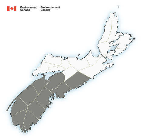
Locations: southern and western Nova Scotia
Time span: Saturday and Saturday evening.
Remarks: Current indications are that snow will begin in southwestern Nova Scotia early Saturday morning and then spread eastward across the province, reaching eastern areas by afternoon. Along parts of the Atlantic coast, especially in the southwest, rain is expected. Over these areas, snowfall amounts will be much lower than inland areas.
Please continue to monitor alerts and forecasts issued by Environment Canada. To report severe weather, send an email to [email protected] or tweet reports using #NSStorm.
More information: http://weather.gc.ca/warnings/index_e.html?prov=ns


