**** Via Environment Canada
Update: the statement has ended and a tropical storm warning is now in effect (see new post)
.
Tropical storm force winds of possible 70 gusting to 100 km/h over exposed areas from Hurricane Teddy may occur over the above regions.
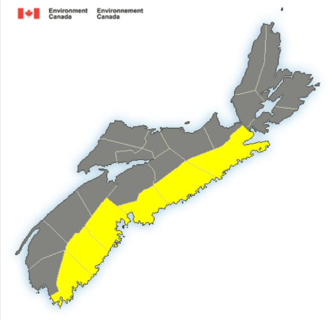
Hurricane Teddy will approach Atlantic Canada on Tuesday and will track through the region Tuesday night and Wednesday.
Potential wind gusts: 100 km/h or possibly higher over exposed areas along the Atlantic coast.
Locations: Atlantic coastal regions of Nova Scotia.
Time span: Tuesday afternoon into Tuesday evening.
Remarks: A band of very strong easterly or northeasterly winds, likely gusting to 100 km/h or higher over exposed areas, is expected to develop during the day Tuesday and be strongest Tuesday afternoon and evening. Another period of strong winds is also likely Wednesday morning as Teddy as pulls away and moves off to the east.
A tropical storm watch means that tropical storm conditions (sustained winds near 65 km/h or more) are possible over parts of the region within 36 hours.
By nature, a tropical storm also implies the threat of local flooding from heavy rainfall – consult your local area forecast for possible rainfall warnings.
Please continue to monitor alerts issued by the Canadian Hurricane Centre and forecasts issued by Environment Canada. Reports of storm conditions and impacts can be emailed directly to [email protected] or by tweeting reports by province using #NSStorm
.
(Weather) The latest info from Environment Canada about hurricane Teddy.
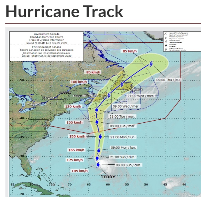
(Newest track via Environment Canada)
Tropical Cyclone Information Statements
Hurricane Teddy poised to impact Atlantic Canada Tuesday and Wednesday.
Hurricane Teddy will likely reach offshore waters south of Nova Scotia on Tuesday as a hurricane, and impact Atlantic Canada and the Gulf of St. Lawrence region in the Tuesday to Wednesday timeframe as a strong post-tropical storm.
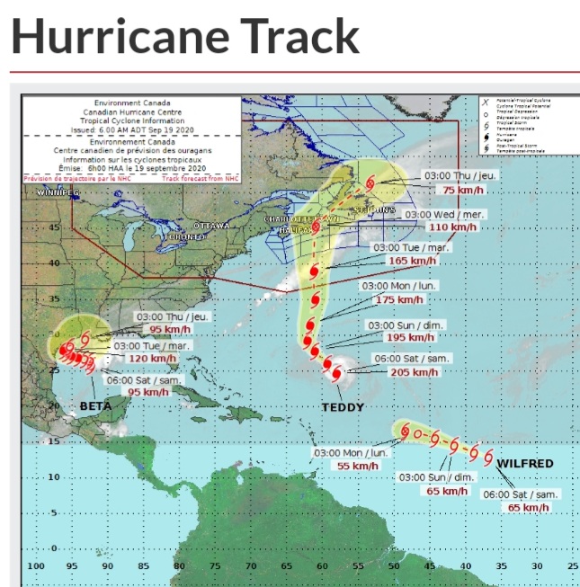
Teddy is currently a category three system over the Tropical Atlantic well southeast of Bermuda. it will slowly move up during the next two days passing east of Bermuda on Monday. This is when it will begin to accelerate towards Nova Scotia. When it reaches Canadian waters south of the Maritimes it will be a category two hurricane, but is expected to be a very dangerous tropical storm as it moves though our region.
Possible impacts:
A. Public
Rainfall could be significant, especially north and west of Teddy’s track. At this point, the highest rainfall amounts are likely for the southern Maritimes and the south coast of Newfoundland. Most regions will see some tropical storm force winds, and south of the forecast track winds may reach hurricane force. Wind impacts may be enhanced by foliage on the trees, resulting in power outages. Every effort should be made to secure temporary structures.
B. Marine
As hurricane Teddy moves into our waters, there is a reasonable chance of hurricane force winds near and south of the track, mainly over the southern Atlantic forecast waters. there will also be large waves, again mainly over southern waters.
C. Surge/Waves
Large waves will build over southern marine waters Tuesday, they will break higher along the Nova Scotia and southern Newfoundland coastline. There will also be rough and pounding surf, especially for the Atlantic coast of Nova Scotia and south coast of


