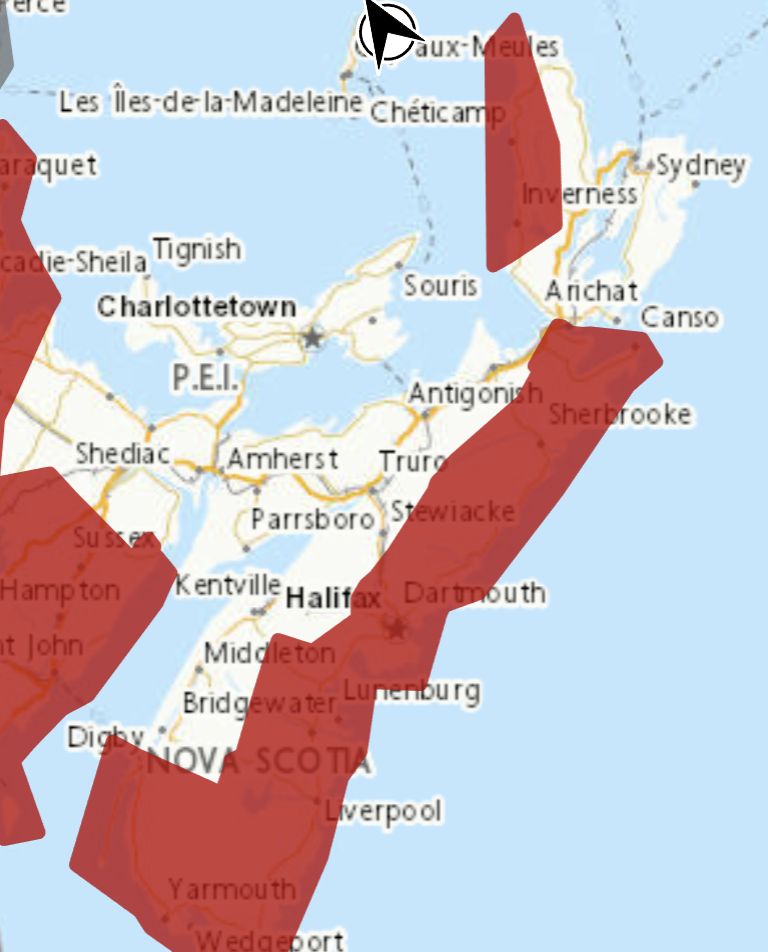
**** Info via Environment Canada
Special weather statement is in effect, rainfall warning remains in effect

Special weather statement
Large waves, pounding surf and elevated sea water levels are expected, possibly exceeding high astronomical tide.
Locations: Atlantic Coast of Nova Scotia and Cape Breton, south facing shorelines.
Time span: this evening through Monday morning.
First high tide: 8 P.M. to 10 P.M. tonight.
Second high tide: 8 A.M. Monday to 10 A.M. Monday.
Remarks: Large waves and pounding surf will produce higher than normal water levels along the coast, especially near high tide. These large waves can cause coastal erosion in vulnerable areas, as well as damage to infrastructure along the shoreline, especially at locations that have been prone to impacts during similar events in the past.
Rainfall warning
Rain, heavy at times is expected.
Total rainfall: 25 to 50 mm.
Locations: Digby County and the Atlantic coast of Nova Scotia from Yarmouth County to Cape Breton County.
Time span: beginning this evening over eastern parts of the mainland reaching Cape Breton County near midnight. Rain ending from west to east tonight through Monday afternoon.
Remarks: The rain will be accompanied by southeasterly winds gusting up to 80 km/h.
Localized flooding in low-lying areas is possible. Be prepared for possible winter conditions at higher elevations.
Please continue to monitor alerts and forecasts issued by Environment Canada. To report severe weather, send an email to [email protected] or tweet reports using #NSStorm.
Source
https://weather.gc.ca/?province=ns&zoom=6¢er=45.07376219,-63.03595700


