**** Info via Environment Canada
Record low ice in Northumberland Strait
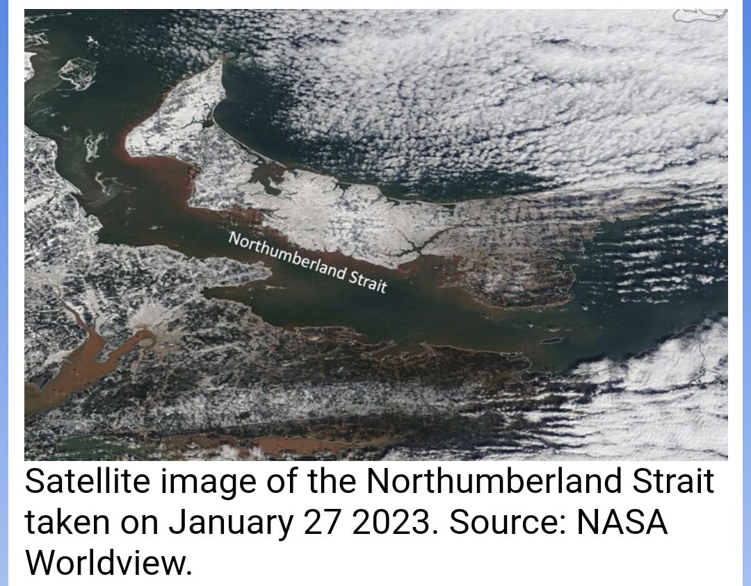
For the second time in three years, and only the second time in the Canadian Ice Service records, the Northumberland Strait remained nearly ice-free at the end of January. The Northumberland Strait is located between Prince Edward Island and the coast of eastern New Brunswick and northern Nova Scotia.
Above-normal temperatures in December and January, particularly for the southern and western portions of the Gulf of St. Lawrence, significantly reduced the cooling of the water, therefore affecting and delaying ice formation.
Satellite image of the Northumberland Strait taken on January 27 2023. Source: NASA Worldview.
Typically, ice starts forming in Northumberland Strait in the first week of January, and it is usually filled by the second week, well before the end of the month. Compared to ice conditions last year, the Northumberland Strait had filled with ice by the end of the second week in January, leading to a near-normal ice coverage for the area by the end of the month.
Satellite image of the Northumberland Strait taken on January 31 2022. Source: NASA Worldview.
The only other winter when ice coverage approached such low values this late into the ice season was in 2021. For context, for the periods covering both our most recent 30-year climatology and our records dating back to 1969, sea ice has always been present in the bulk of the Northumberland Strait at the end of January.
This map shows how often sea ice has been present during the last week of January over the 30-year period from 1991 to 2020. Blues and grey mean that sea ice is present more often than not, while yellows and orange mean that sea ice usually would not be present.
Visit the Canadian Ice Service Web page for the latest ice conditions.


