**** Info via Environment Canada
August temperature outlook
Let’s have a look at the map for the month of August, to see whether temperatures in your region will be below or above average.
The forecasts are categorized as follows:
- blue indicates the probability that temperatures will be below normal;
- grey to purple indicates the probability that temperatures will be near normal;
- yellow to red indicates the probability that temperatures will be above normal; and
- white indicates uncertainty regarding the temperature tendency this month.
All categories are compared to the 30 months of August between the 1991-2020 period. This map is a prediction of the daily average temperature anomaly (difference from normal) at 2 metres, the standard forecast height. It is not a daily maximum or minimum temperature forecast.
Long-range forecast user guide.
July overview
July was very active, with different parts of the country seeing severe thunderstorms, flooding and heat.
On Canada Day, an EF-4 tornado touched down near Didsbury in southern Alberta. It was the strongest recorded tornado in Alberta since the 1987 F-4 Edmonton tornado. On the same day, torrential rain fell in central Quebec, and again a week later, leading to floods. Many severe thunderstorms also resulted in tornadoes, large hail, and strong winds. Particularly notable were tornadoes in Barrhaven, ON and Mirabel, QC on July 13, baseball-sized hail in southwestern Ontario on July 20, and two tornadoes and large hail in central Alberta on July 24.
Extreme rainfall and flash flooding impacted Nova Scotia July 21 to 23. Areas around Halifax received 100 up to 300 mm in some locales. Meanwhile, tropical storm Don skirted by the Grand Banks and brought some wind and waves to the Atlantic waters.
Map of precipitation accumulation from July 21 to 23 over the Maritime region.
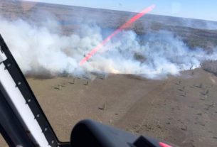
Wildfires and high temperatures also impacted Canadians this month. Wildfires raged nationwide, spreading quickly in Quebec, British Columbia, Yukon, and Northwest Territories. A lack of precipitation further exacerbated drought conditions, leading to record low water levels in parts of the Northwest Territories.
The hot weather was felt across the country, but most notably in Newfoundland and Labrador, British Columbia, and the North. Many daytime maximum temperature records were set, with an all-time record high temperature of 33.0°C in Inuvik, NT on July 4.
Map of the temperature anomaly (difference from normal) across the country for July.


